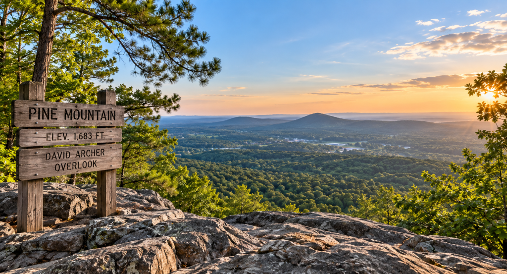
One of the things I keep discovering while digging deeper into Bartow County is how many places we have that make you say:
Wait. That’s right here?
Pine Mountain is one of them.
You don’t have to drive north into the Georgia mountains every time you want hiking boots, trees, elevation and a view.
You can find all of that right here in Cartersville.
And unlike Dellinger Park, where I basically told you to pack a sandwich and wander around…
I’m going to give you one warning about Pine Mountain:
This is an actual hike. 😂
The City of Cartersville currently maintains multiple routes up Pine Mountain, with both moderate and difficult trail options leading to the summit at David Archer Overlook.
So we’re graduating from cute walk around the lake to:
“Why did I think this sounded fun?”
But apparently the view at the top is where you remember why. 😂
There Are Two Main Trailheads
This is important because you have choices.
The City of Cartersville currently identifies two primary parking/trailhead areas:
Main Street Parking & Trailhead — off Komatsu Drive
Spur 20 Parking & Trailhead — at 946 Highway 20 Spur
Both have routes that lead to David Archer Overlook at the summit.
And this is where Pine Mountain gets interesting.
You’re not choosing between:
Trail or no trail.
You’re choosing your particular flavor of suffering.
😂
Pick Your Trail Carefully
From the Main Street Trailhead, the city lists:
Boot Trail — Moderate
Approximately 1.05 miles to the summit
Hiking Poles Trail — Difficult
From the Spur 20 Trailhead, you’ve got:
Pocketknife Trail — Moderate
Approximately 1.16 miles to the summit
Backpack Trail — Difficult
Approximately 1.82 miles to the summit
The city’s online listing currently appears to contain a typo showing the Hiking Poles Trail as “98 miles” to the summit, so I’m not repeating that number as gospel because unless Pine Mountain has quietly relocated to Tennessee, something has gone terribly wrong there. 😂
The important takeaway:
Check the current trail map before you go and choose the route that matches your ability.
City of Cartersville Pine Mountain Trail Map
And Then You Reach David Archer Overlook
That’s the payoff.
The routes climb to the summit at David Archer Overlook, where you get the kind of elevated Northwest Georgia scenery that makes the uphill portion suddenly seem like an excellent life decision.
This is also exactly the kind of place where I know what happens:
You hike uphill.
You question your choices.
You arrive.
You take 47 pictures.
And suddenly you’re telling everybody:
“Oh, it wasn’t that bad.”
Liar. 😂
But that’s hiking.
There’s More Here Than Just One Up-and-Back Trail
The current Pine Mountain trail map shows a larger interconnected trail system, including the Cooper’s Furnace to Pine Mountain Connector Trail, along with landmarks carrying names like Whiskey Point, Fatman Squeeze, Hurricane Hollow and Two Bridges.
Now THAT sounds like Georgia hiking.
Because apparently we cannot simply name things:
Trail A.
No.
We’ve got to send you toward somewhere called Fatman Squeeze and let you figure out the rest yourself. 😂
The connector toward Cooper’s Furnace is particularly interesting because it gives hikers another way to experience the area’s outdoor landscape while connecting into another piece of local history.
This Is One to Prepare For
Pine Mountain isn’t the place I’d recommend showing up in flip-flops carrying one half-empty bottle of water you found rolling around on the floorboard.
The city specifically recommends bringing water, snacks and a camera, and reminds hikers to pack out what they pack in.
I’d add:
Wear actual walking or hiking shoes.
Check the weather.
Download the trail map before you start.
Know which trailhead you used.
Choose a route appropriate for your fitness level.
And bring enough water.
Georgia has a special talent for turning what looked like a perfectly reasonable temperature into:
SURPRISE. YOU’RE HIKING ON THE SURFACE OF THE SUN.
Especially before Fake Fall actually commits. 😂
Put This One on the Fall List
And speaking of Fake Fall…
Pine Mountain feels like exactly the kind of Bartow County outing that belongs on the list once the temperature finally stops personally attacking us.
The leaves.
The elevation.
The views.
The cooler air.
That’s a very different Bartow County experience than spending a day at Tellus or the Booth—and that’s exactly why I’m loving this series.
We have more variety here than people realize.
Another Reason to Stop Automatically Looking Toward Atlanta
This is becoming a recurring theme around here.
We live in Bartow County and somehow still get into the habit of thinking:
What can we drive somewhere else to do?
Meanwhile, there’s a mountain sitting in Cartersville.
Between museums, local history, parks, trails and outdoor recreation, there are plenty of things to do in Bartow County without automatically heading south on I-75.
A Front Porch Rachel Thought
This is exactly why I wanted Around Bartow to become more than restaurant recommendations and event calendars.
Because knowing a place isn’t just knowing where to eat.
It’s knowing where to take your grandkids.
Where to spend Saturday morning.
Where to walk.
Where to hike.
Where to learn something.
Where to go when you need to get outside and clear your head.
And sometimes…
where to voluntarily walk uphill for more than a mile because somebody promised you there would be a pretty view at the end.
😂
Pine Mountain gives us another one of those places.
And if you’ve hiked it before, I need you to answer the important question:
Which trail should a first-timer take—and how much are their legs going to hate them the next morning?
Real Estate. Real Life. Rachel.
Trail conditions, access and routes can change. Check the City of Cartersville’s current Pine Mountain information and trail map before hiking.


Leave a comment